 |
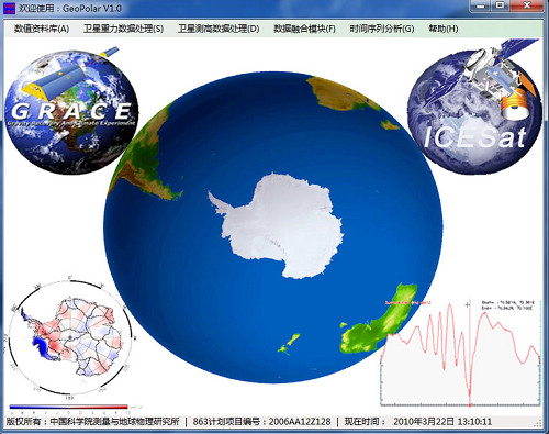
| Main Interface for GeoPolar V1.0 Software |
Institute of Geodesy and Geophysics, China Academy of Sciences (CAS) won the first prize of Surveying and Mapping Science and Technology Progress on November 9, 2010.
Surveying and mapping science and technology progress prize is of great importance in the field of geodesy in China. It is awarded by the Chinese Society for Geodesy Plotogrammetry and cartography.
The research team took full advantage of geodesy and remote sensing and integrated the theories and methods of satellite gravity, satellite altimetry and remote sensing image together to explore the ice mass in the South Pole area, the distribution of ice in the upper covered area and the change trend of long time span.
The team has also developed software named GeoPolar V1.0. This software can help to research the relationship between ice mass change and change of sea level, the flow of underground water, the climate change and the dynamical process of earth interior in South Pole Region.