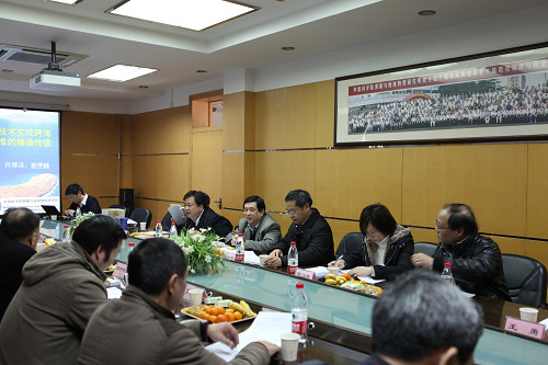
The project “Accurate vertical datum transfer methods across the sea base on gravity potential difference”, which is commit by the institute of Geodesy and Geophysics, Chinese Academy of Sciences. passed the identification on February 19. This project provided a new technique method of elevation transmission along China Sea Island and Coastal Sea. In general the result reached the international advanced level.
Seven identification committee experts came from State Bureau of Surveying and Mapping, Wuhan University, Xi'an Institute of Surveying and Mapping, Chinese Academy of Surveying and Mapping, Institute of Seismology, China Seismological Bureau and other institute. Academician Chen Jun-yong, Ning Jin-sheng, Wei Zai-qing were appointed director and deputy director of the committee respectively.
Reports including the research team, technical research, test report from test group of the identification committee and novelty search report were presented. After question and discussion, identification of the Committee agreed that: the method from the project of “pass the vertical datum across the sea base on gravity potential difference” could be used to pass the 1985 vertical datum to the Coastal Sea area, and transform the GPS geodetic height of this area to the 1985 height system conveniently. The conversion accuracy was better than ± 10cm.The results of the project was original and had important theoretical significance and application value. The Committee also recommended that the software achievement for further engineering in order to promote the use of the technology.
ZHENG Chun-bai, deputy director of Science and Technology Department of Hubei Province, and director Sun He-ping were present the meeting.

Committees at the identification meeting (a)

Committees at the identification meeting (b)

