Home  |Picture  |  Contact  |  Sitemap  |  中文  |  CAS
About Us  │  Scientists  │  News  │  Resources   │  Papers  │  Research  │  Join Us
  News
  Events
  Int’l Cooperation News
  Upcoming Events
  Location: Home > News > Events
WHIGG simulates the flood area triggered by tsunami in Sendai Japan. TEXT SIZE:A A A

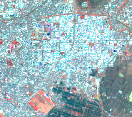
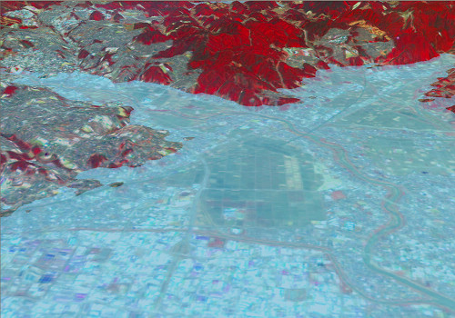
PH.D Chai Xiaobin simulated the flood area triggered by tsunami in Sendai Japan. He made used of image data of ASTER GDEM and EO-1ALI, and the simulation result showed a heap of rubble in the simulate flood area. The ASTERE GDEM image used was the highest resolution DEM model with global coverage. The EO-1 AL1 image data was the latest image after the big hit, and the background of the image was ALI multiband data whose resolution was improved to full color 10m by adopting image fuse technic.

 Simulate result of flood area in Sendai Japan after tsunami
(Data source: ASTER GOEM and E0-1 ALI)
 
 Ruined city of Sendai Japan after tsunami
 

Three-dimensional striograph of tsunami in Sendai Japan.

 
Institute of Geodesy and Geophysics. Chinese Academy of Sciences
Address:340 XuDong Rd. Wuhan 430077, Hubei, China
Email:zhaohong@asch.whigg.ac.cn